This is a pilot project exploring in depth the urban and social dynamics of two of the most important popular neighborhoods in Cairo, Egypt: ‘Izbit Khayrallah and Mit ’Uqba. This research aims to provide the tools for a better understanding of the process of production, reproduction and change in these under deserved as well as vastly misunderstood areas. While observing and understanding these neighbourhood from a neutral point of view, it is important to see them as “ordinary” popular neighborhoods. The latter are often characterized by certain levels of state dismissal and neglect, however they present a high level of self-organisation. For a period of 6 months, a team of 4 architects including myself along with the collaboration of LAVUE team in Paris, a research unit of the CNRS (The National Center for Scientific Research) consisting of two urbanists and one sociologist gathered as much data as possible, by conducting physical surveys, interviews, and other methods of research. Throughout this process, different urban and social themes were covered such as urban development, existing housing typologies, community ties and structures. This project was first presented as a publication to the Agence Francaise de Development, which in addition to the documentation contained a proposal focusing on elements to be developed immediately in each neighborhood. An assessment will then be done as to whether the project qualifies for a grant. This project does not only target the Agence, but also has another more important message in my opinion from which the name “A parallel narrative” originated. It aims at unveiling the realities of the neighborhoods from the viewpoint of every entity involved in the structure of these settlements; the inhabitants, the organizations and the government. What was striking was that popular and official narratives were completely contradictory, which results in neglect and blame sometimes even conflicts.
Urban Growth
In order to form our analysis for the two neighbourhoods, the team tracked the urban development and changes in the land over the years. This data was produced from old maps provided by the CEDEJ, narratives from the inhabitants and administrative officials. In this production, my tasks were data gathering and the execution of the analysis for the territory of ‘Izbit Khayrallah. My tasks also included writing a three pages article on this analysis and working on the direction of the visuals and the graphic language. In this task, one of the challenges was in many cases to obtain consistent information. Sometimes the narratives were inconsistent with the maps driving the team to conduct further research. Another challenge was the excessive data gathered. What was difficult was to choose the focus of each visual, what to show and what not to show in order for the visual to be readable and comprehensive. Another thing the team had to make sure of is the consistency in the visual language. Despite their different stories, these two neighbourhoods had to have a certain homogeneity in the visual structure and color pallette.
‘Izbit Khayrallah’s Urban growth
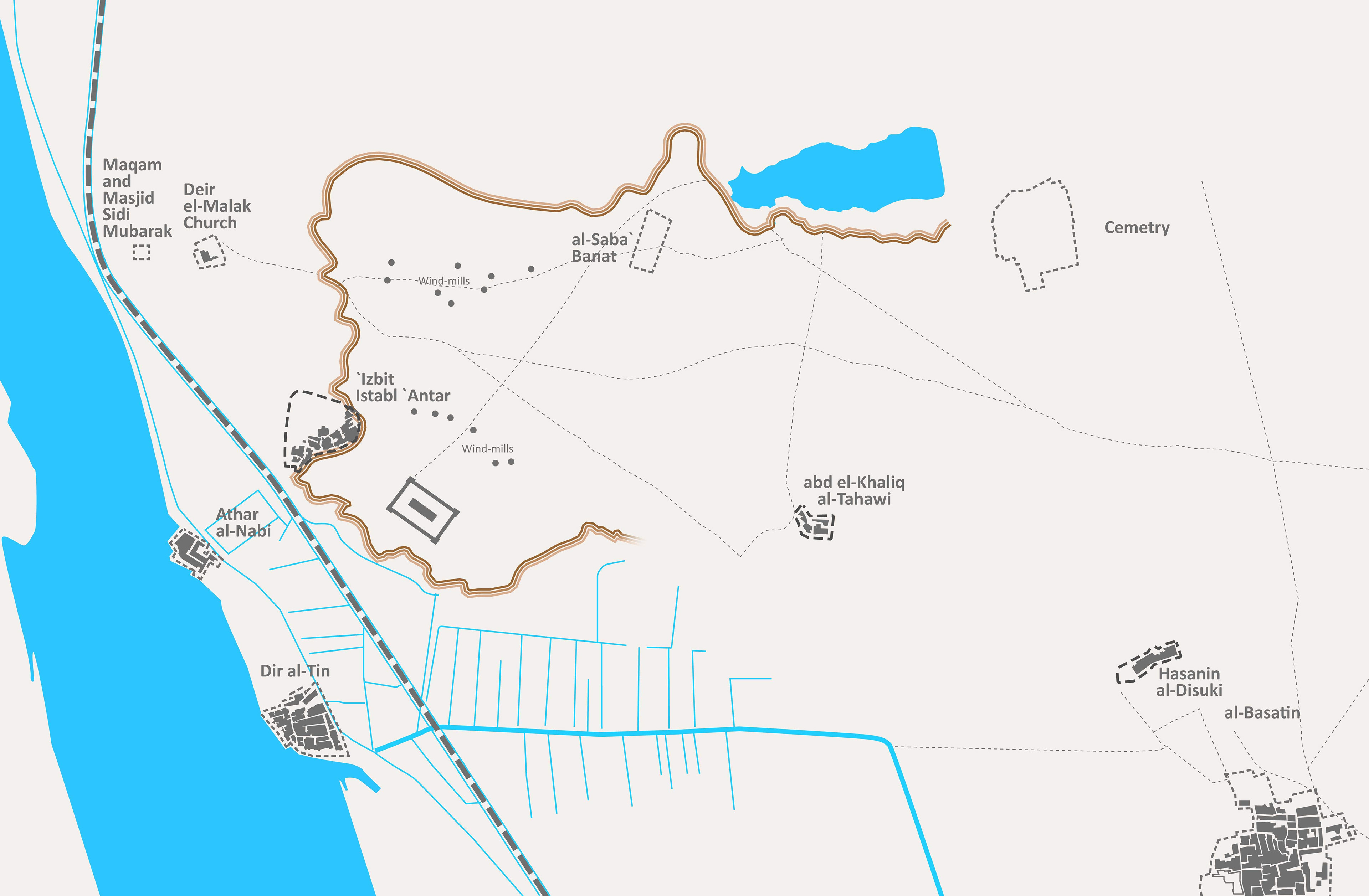
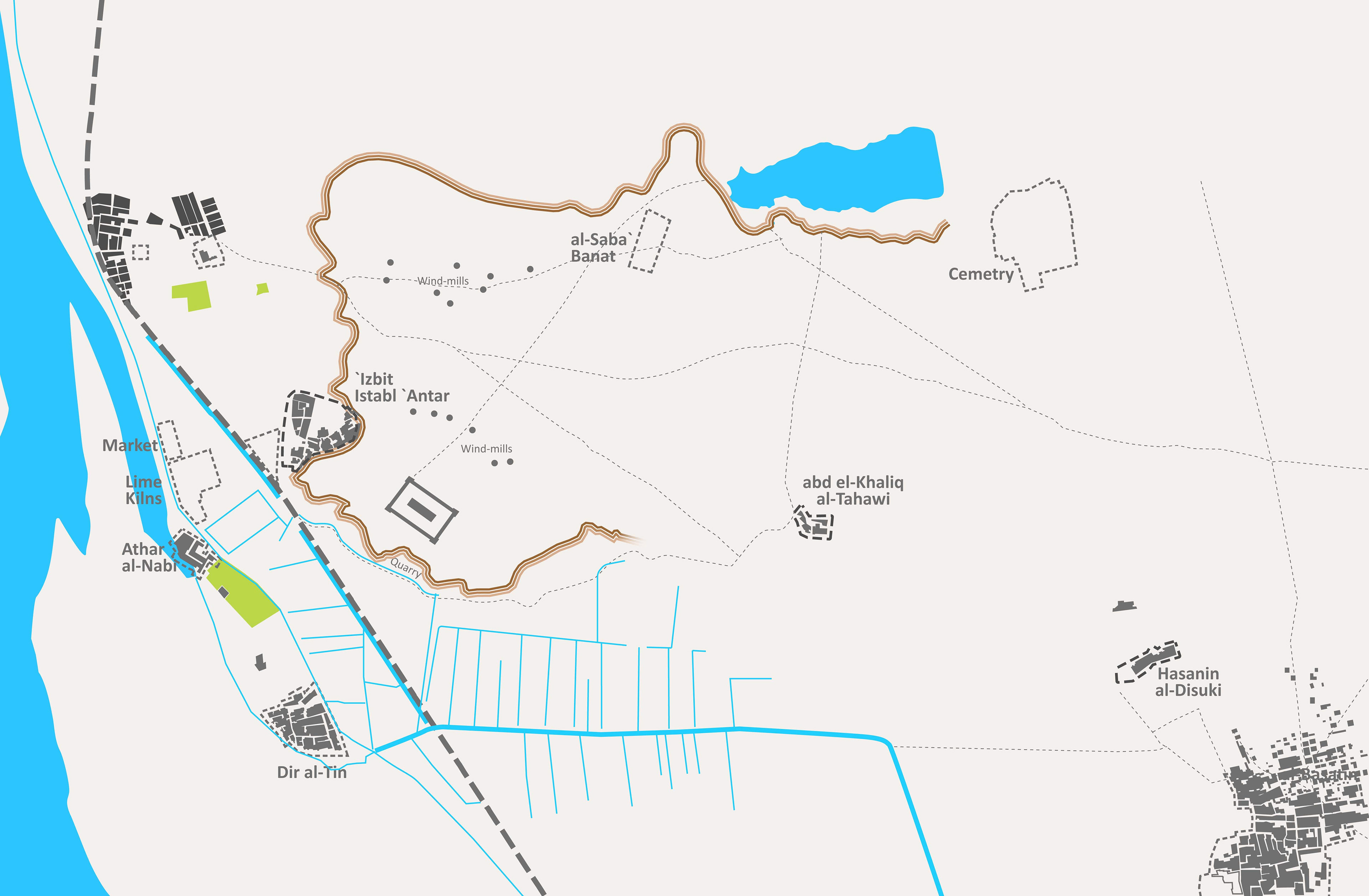
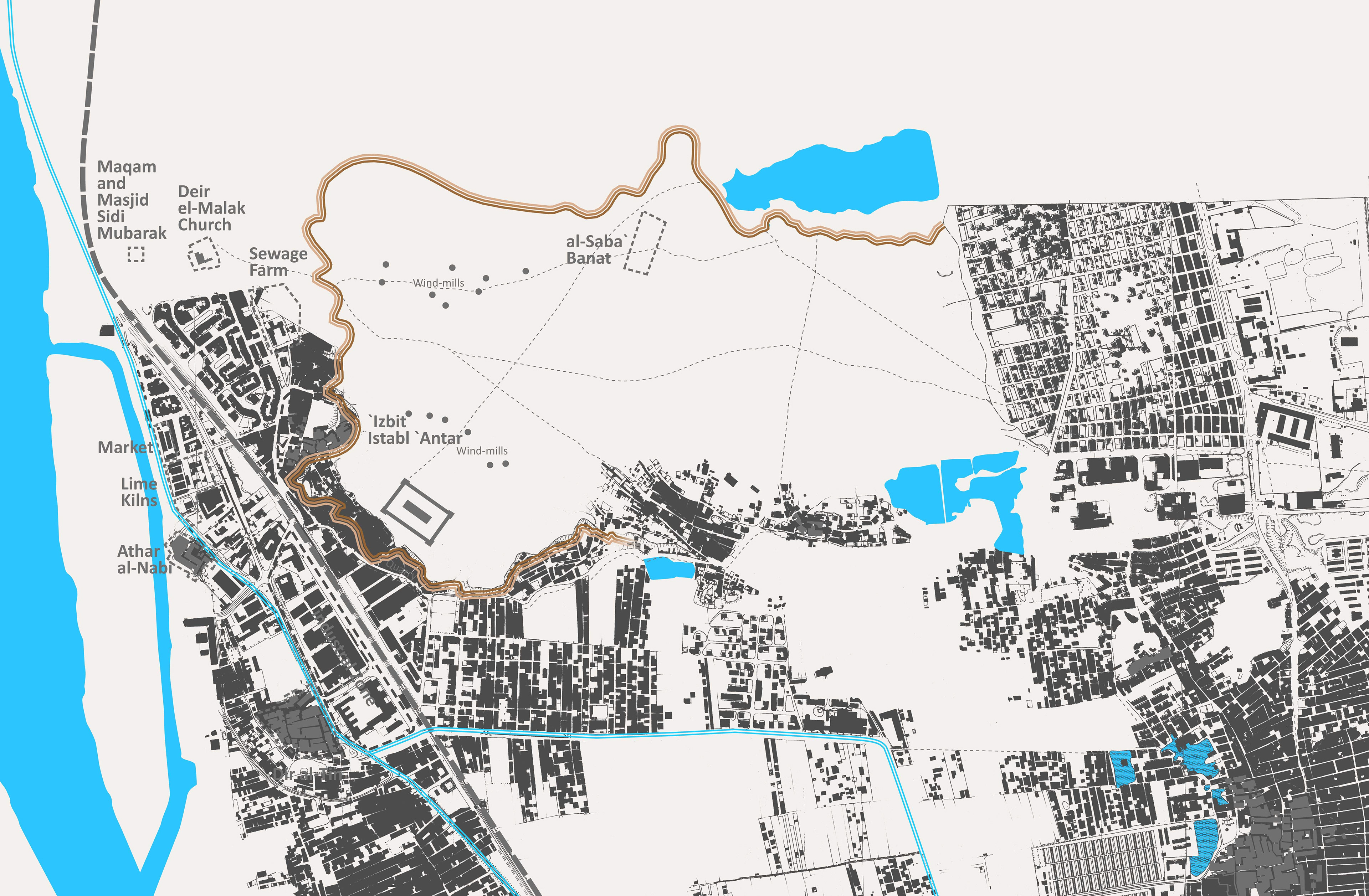
From left to right:
“Misr al-Qadima in 1918 - Cairo’s early Fatimid Era settlement to 1900s’ urban expansion”
“Misr al-Qadima in 1952 - The start of industrialization and scattered urban development till the 1950’s”
“Map of Misr al-Qadima in 1977 - Urbanized surroundings yet still an empty core with developing entry point”
Mit ‘Uqba’s Urban growth
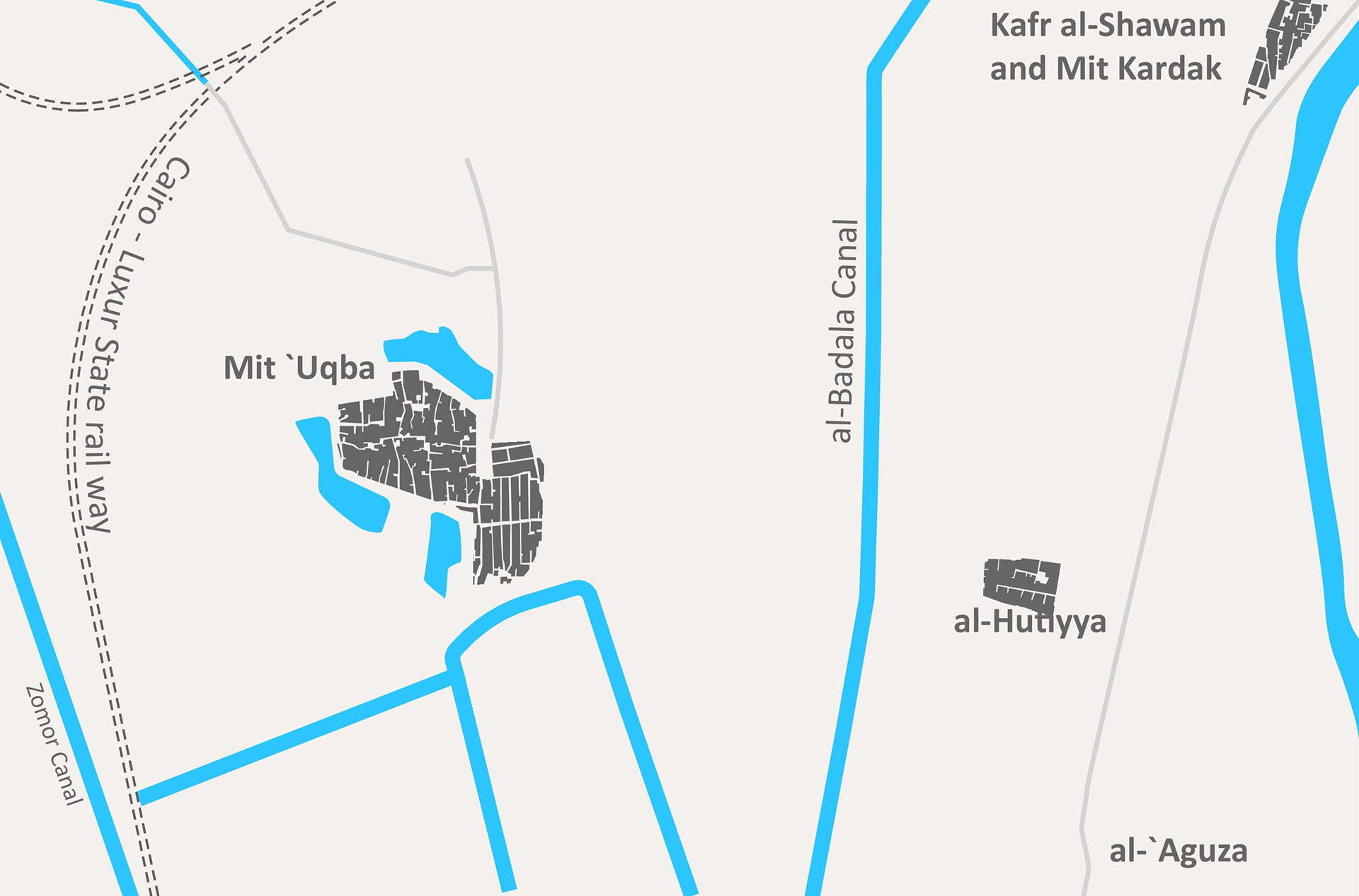
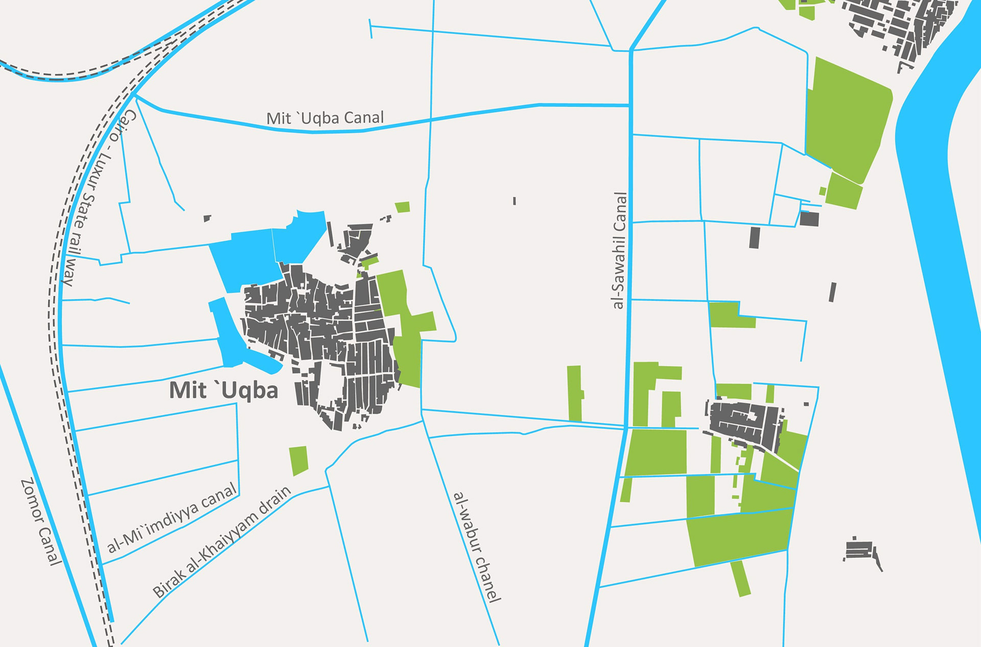
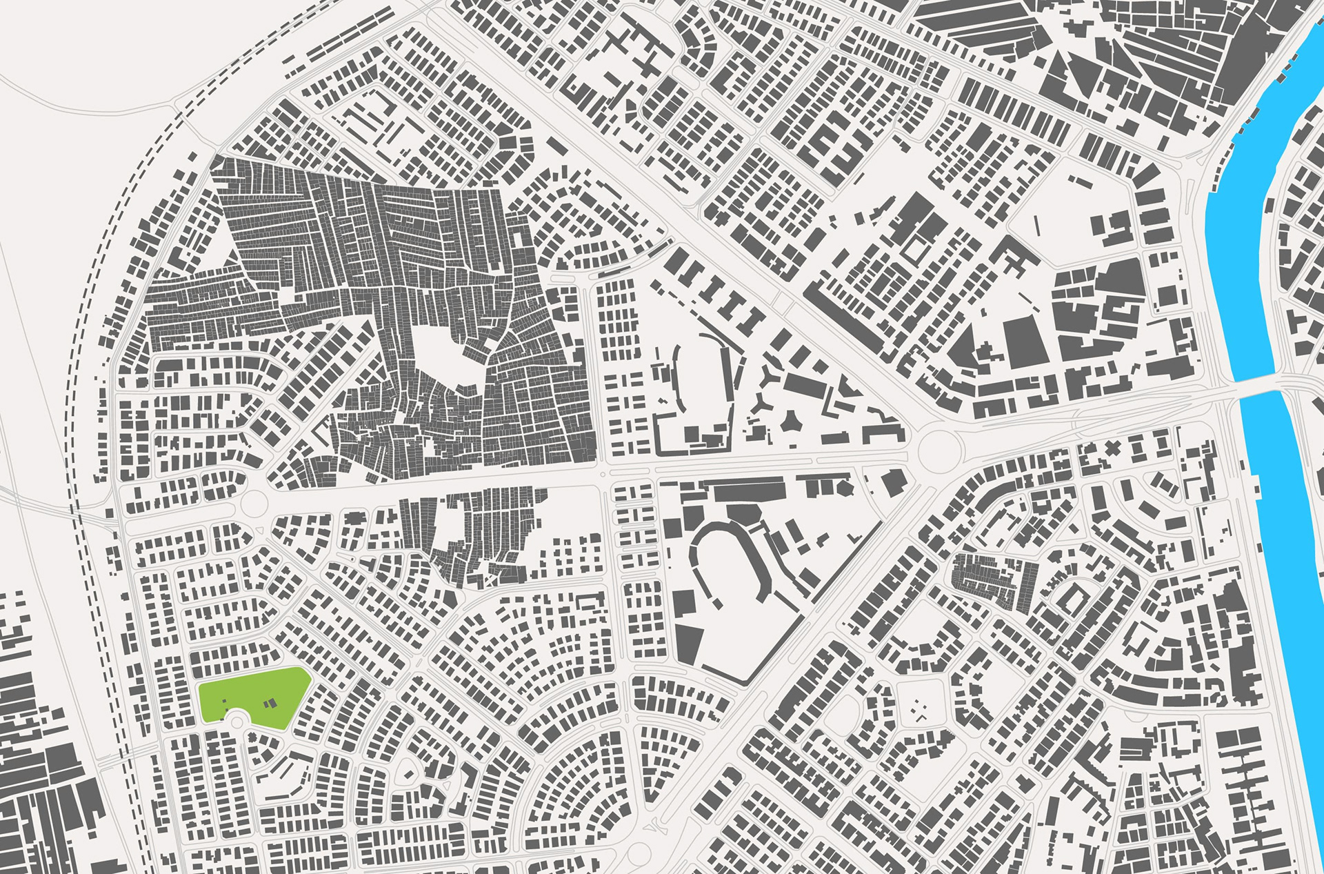
From left to right:
“Mit ‘Uqba in 1896 from the early 19th Century and up until the early 20th Century: The internal growth of two villages on the West Bank of the Nile”
“Mit ‘Uqba in 1932 from the early 20th Century and up until 1952: internal growth over agricultural land and enduring landmarks”
“Mit ‘Uqba in 1978 1960-1980’s: Rapid urbanization and near-complete internal saturation”
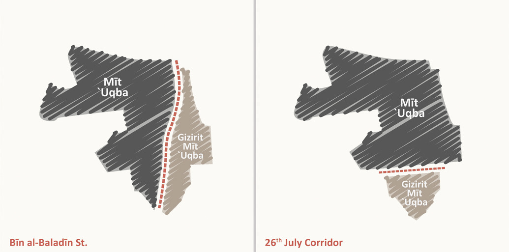
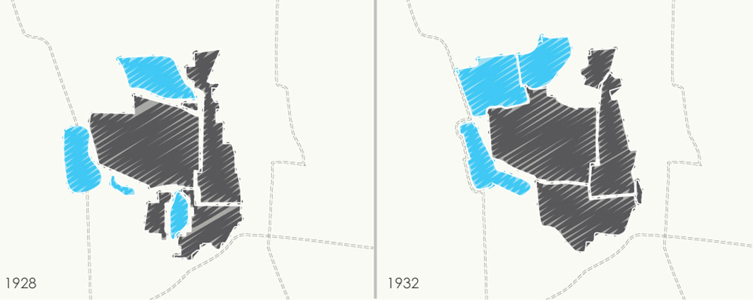
Mit ‘Uqba’s structural changes over time
“Apart from the apparent impact this superimposition on the area in terms of redistribution of services and access of each district to main facilities, this structural change has also served a more substantial role in political terms, where the confinement of the area now perceived as Gizirit Mit `Uqba, a much smaller locality than the original Gizirit Mit `Uqba area and with less grounds for sustainability than the now-prevailing Mit `Uqba zone, has made it weaker and more vulnerable to eradication by the State and rumored by the locals to be the eventual plan of the Municipality.”
Urban Study Maps - ‘Izbit Khayrallah
‘Izbit Khayrallah in the city
`Izbit Khayrallah is one of the largest precarious urban settlements in Egypt. It is located in the south of Cairo governorate. It falls under the administrative control of four different districts. ‘Izbit Khayrallah comes into contact with major city-wide circulation axes, such as al-Corniche, Salah Salim Cairo’s Metro system, and al-Autostrad. This location makes `Izbit Khayrallah a very central neighborhood, but paradoxically very difficult to access. This ultimately leads to the community of Khayrallah’s segregation and to the internal limit of vehicular and pedestrian accessibility.
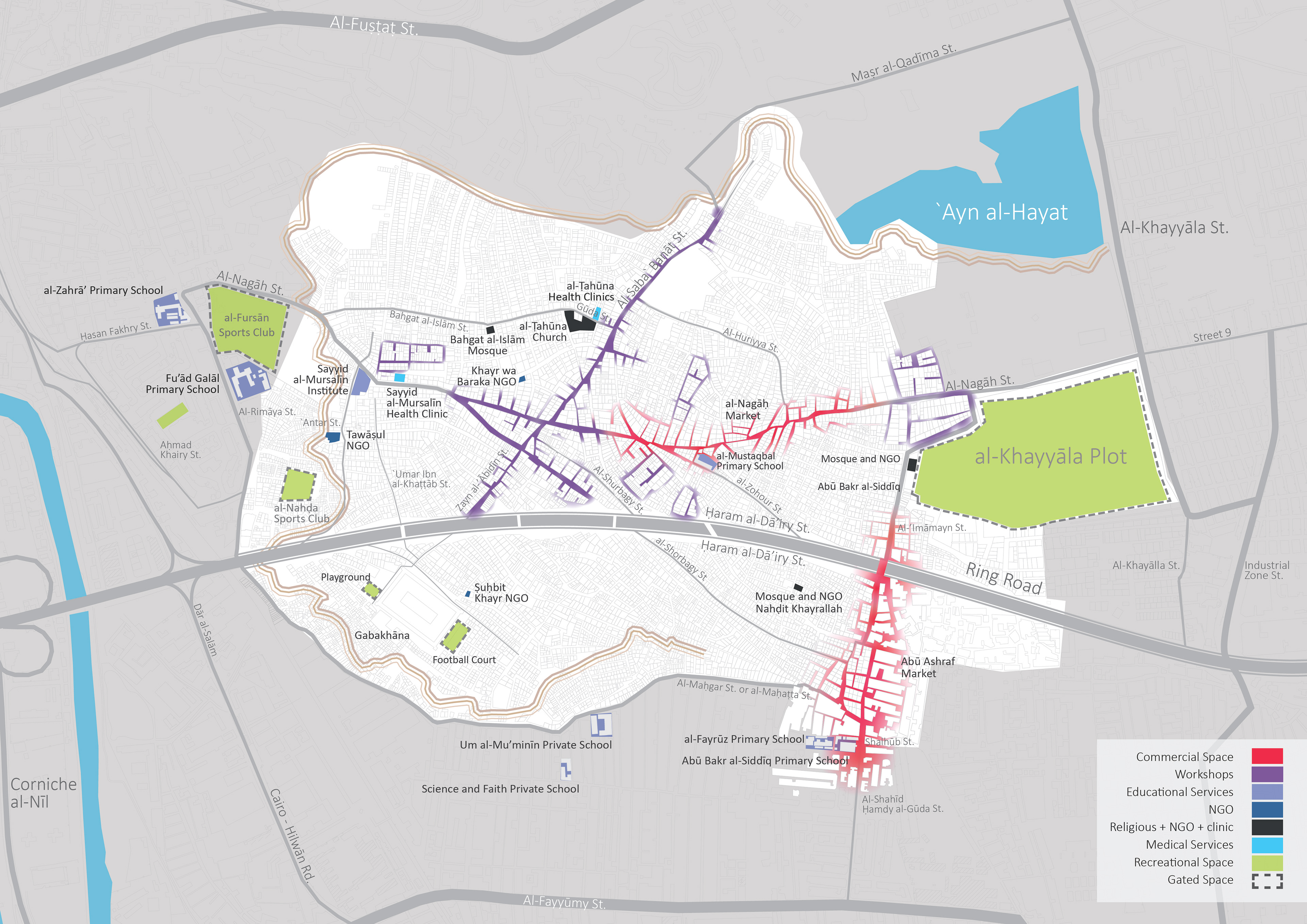
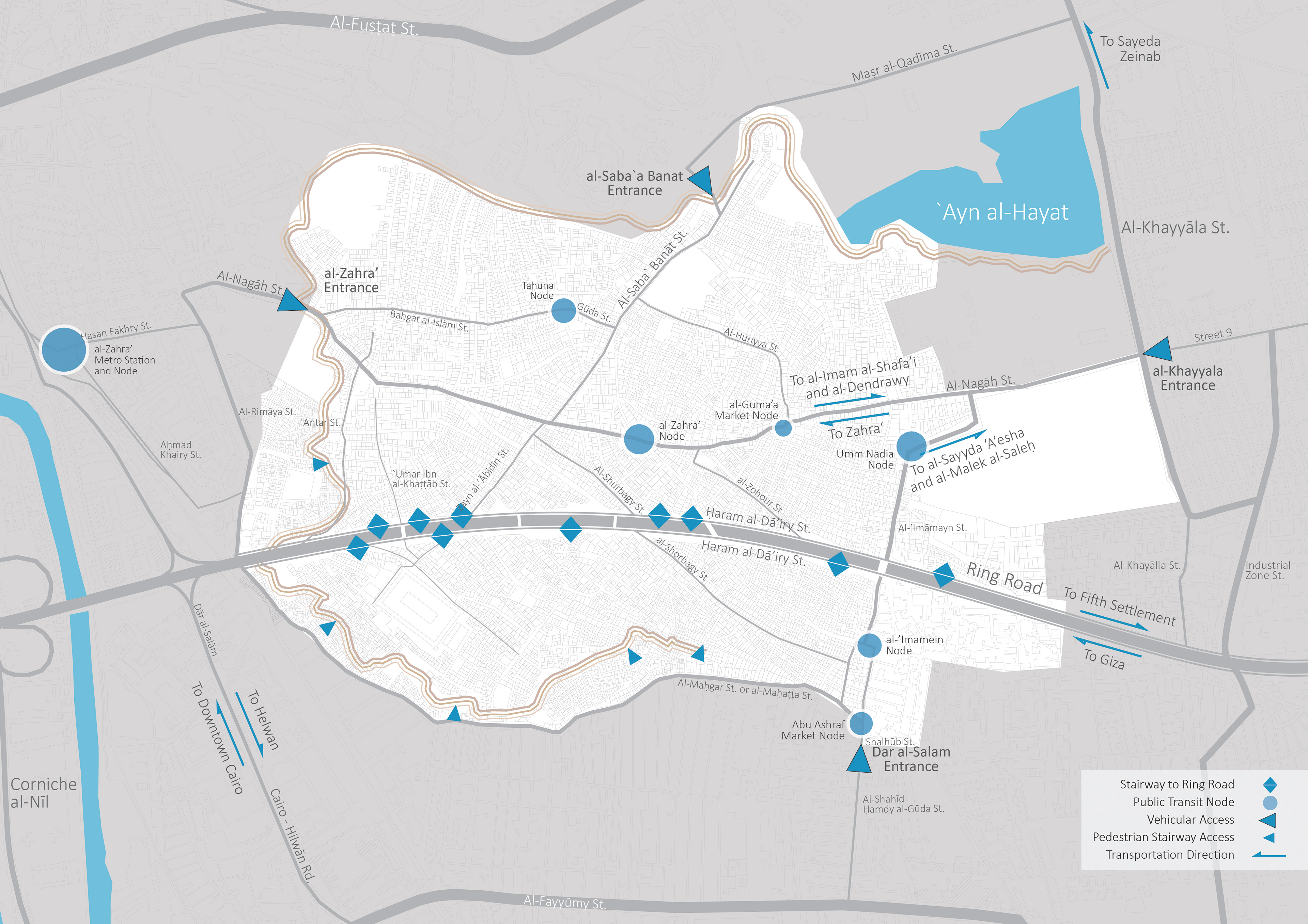

From left to right:
Activities and uses: “Being a squatter settlement, `Izbit Khayrallah is very limited in terms of its offered governmental facilities and services. In order to sustain, external entities started providing these types of services to the neighborhood such as medical and educational services. But still, sometimes residents are forced to resort to neighbor- ing areas in order to meet their needs[...]”
Accessibility and mobility: “In certain parts of the `Izba, vehicular access is impossible due to the extreme and rapid changes in slope. `Izbit Khayarallah has a limited number of vehicular entrances and each has its own physical characteristics and users.[...]”
Kevin Lynch analysis: “The `Izba's edges are clearly defined by the harsh topography of the plateau on which it is located.What causes an issue is the southeastern side of the plateau, because it does not have a definite boundary; in fact it is the entry point of the cliff. Another important feature to note is the Ring Road constructed in 1989 to 2000 (Sims, 2010). Despite the fact that it was planned as a path connecting the area to its surrounding context, it currently divides `Izbit Khayrallah into a northern and a southern side[...]”
Infrastructure History
This timeline in particular was a challenge for me because i spend a lot of time trying to filter the information so that the visual could be clear for the reader and not too overwhelming. This visual is also very special to me because i gathered all the information from inhabitants, administrative officials to neighbouring areas. It was an interesting process because it gave me the chance to look in perpective and try to understand the situation.
The infrastructure story in ‘Izbit Khayrallah is one of if not the most important issue in the publication in my opinion. The story is full of details of social and political changes affecting the access to these basic infrastructure amenities.
Timeline of 'Izbit Khayrallah's infrastructure
’Izbit Khayrallah struggles with infrastructure below the adequate or minimum levels while trying to obtain recognition as a settlement, thus getting the primary needs they require. The struggle happened in four phases as seen above: the informally formed connec- tions, the impact of a political mobilization, the (City-scale) mobilization and finally the normalization. These phases are further developped in a 4-pages article.
Housing Typologies
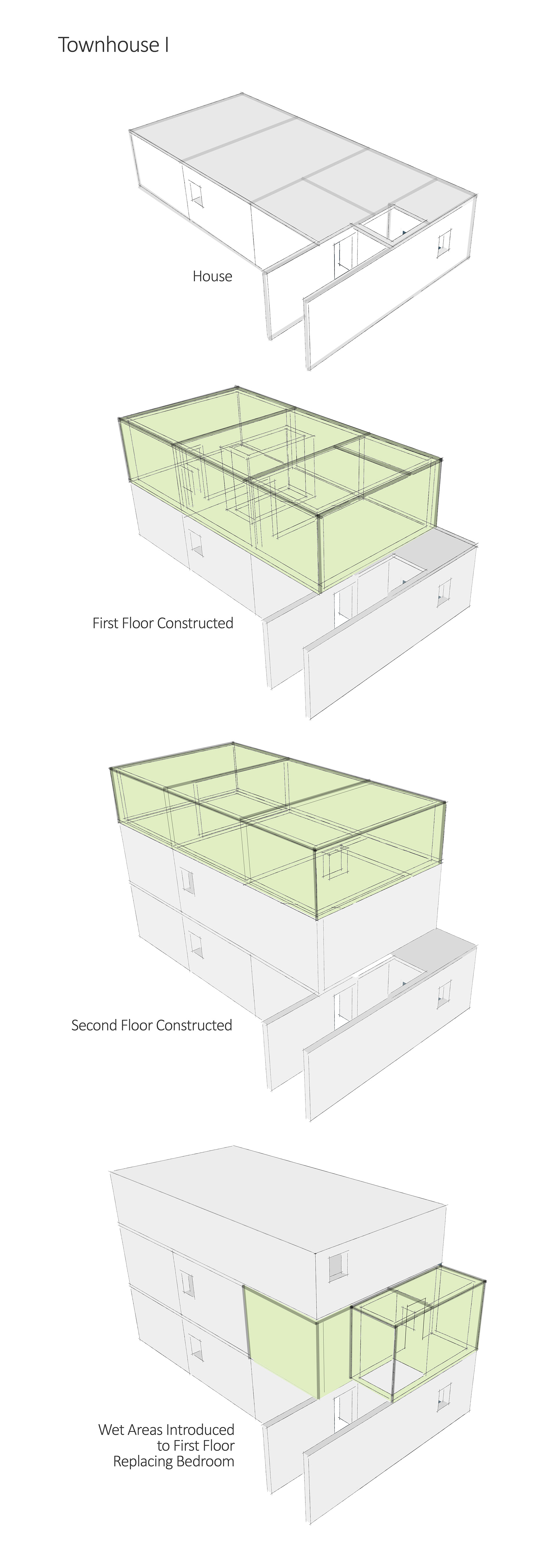
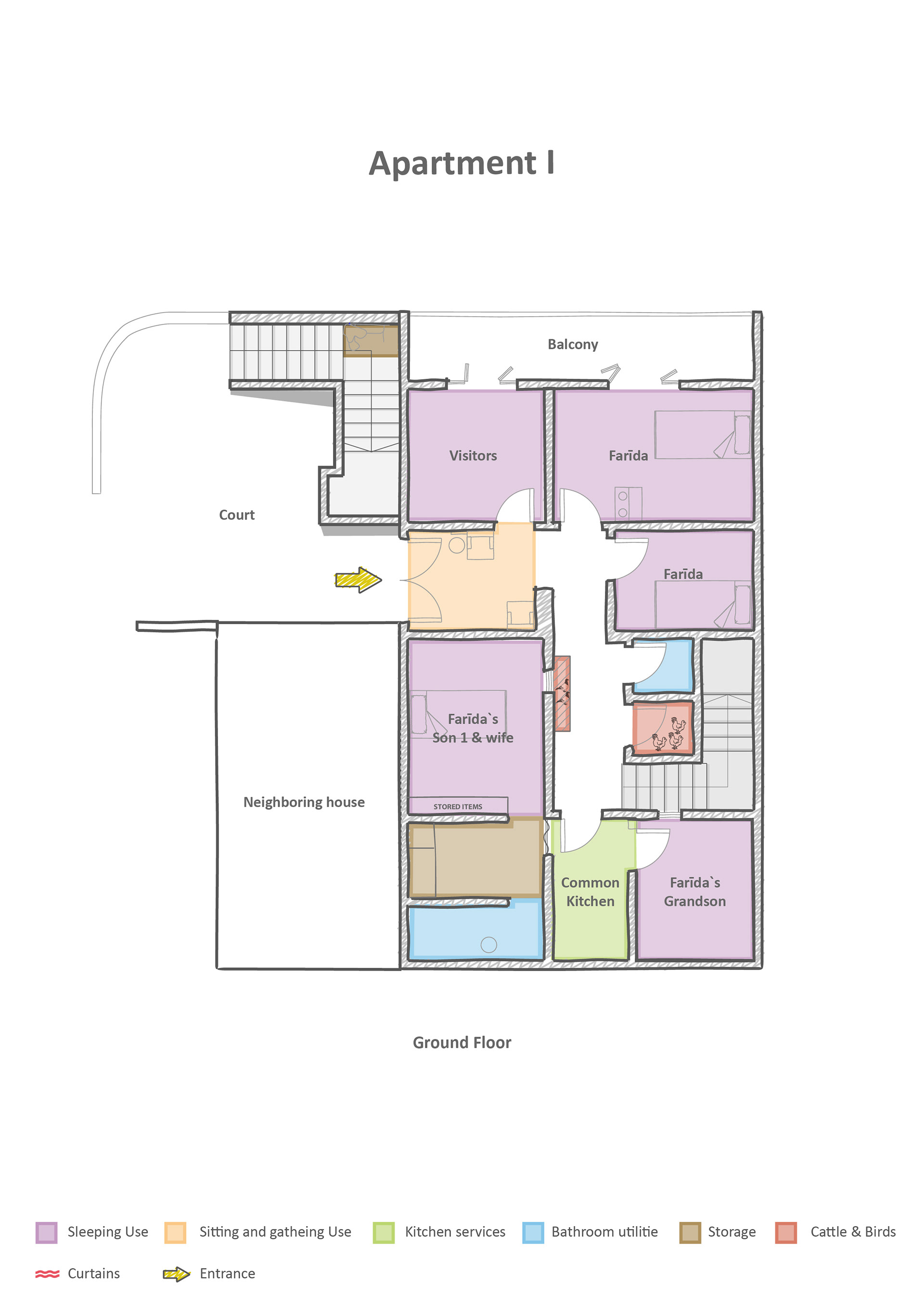
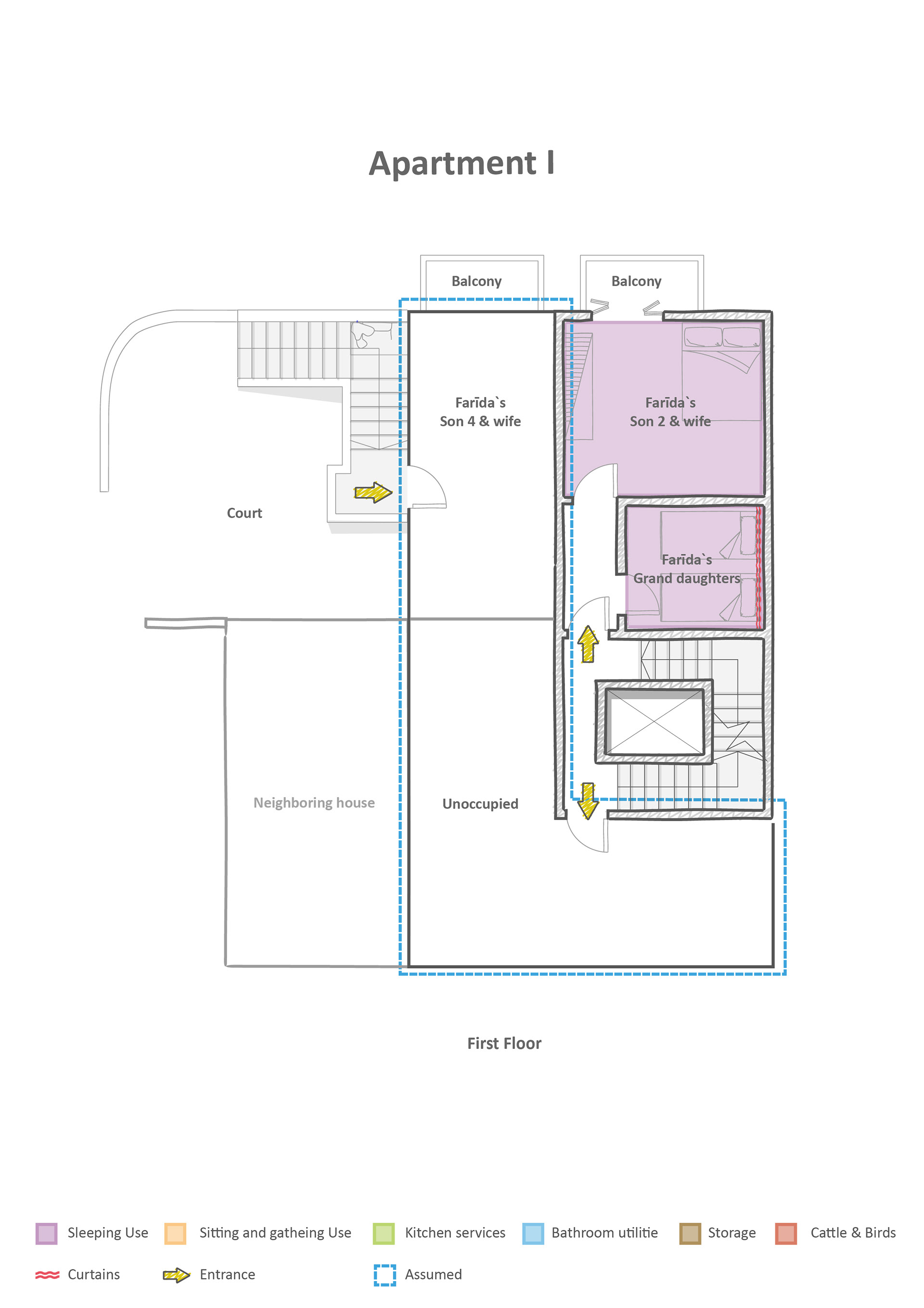
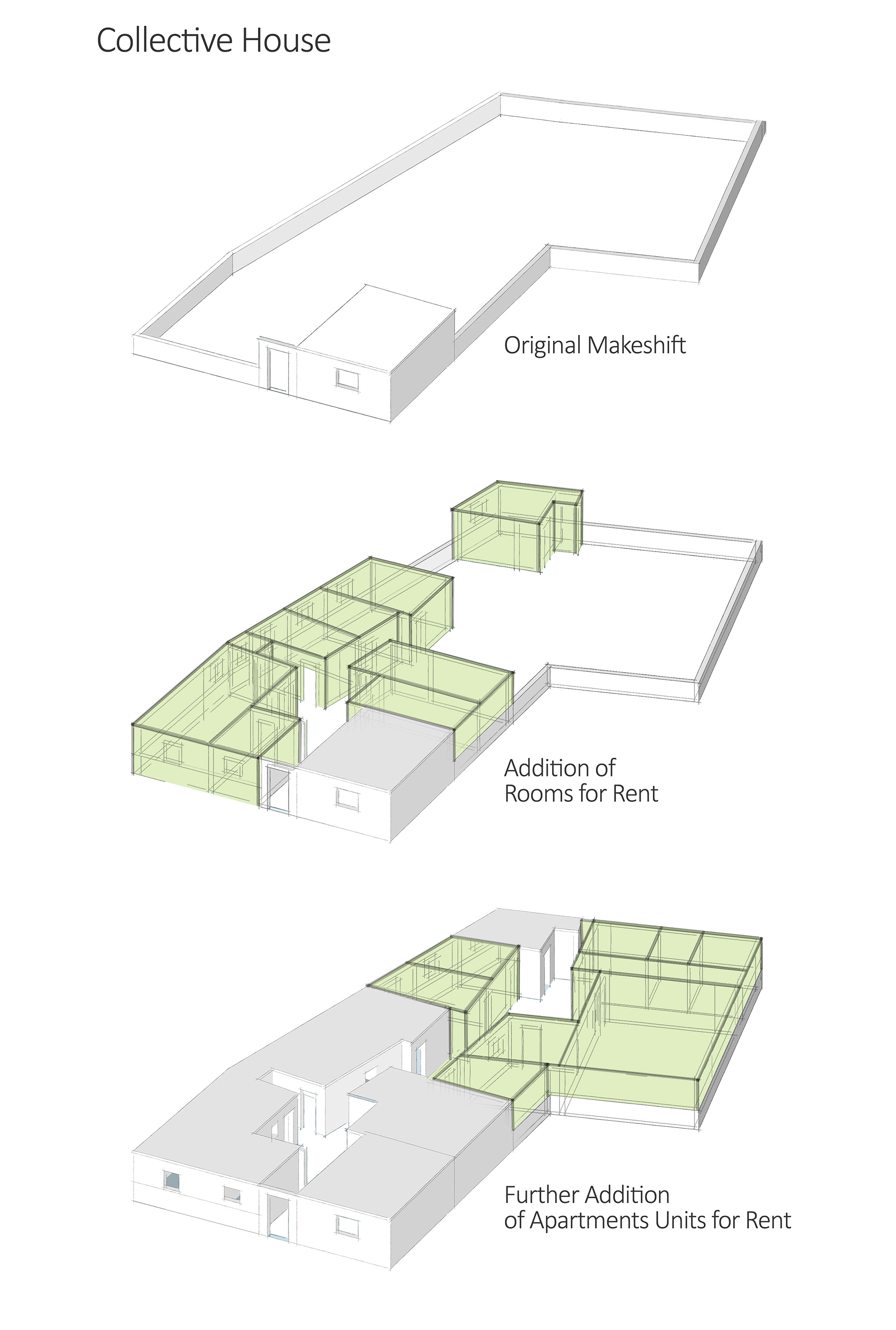
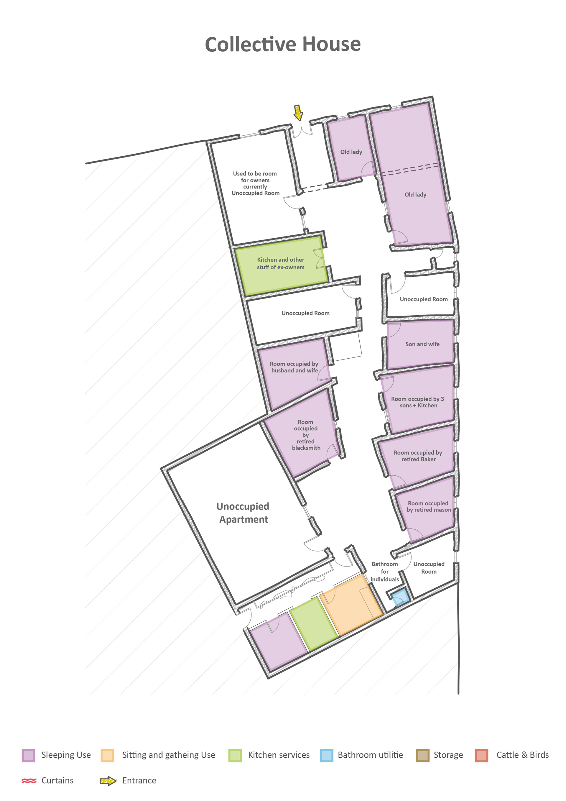
Studying housing typologies in’Izbit Khayrallah was an interesting experience in the sense that it brought me closer to the area’s informal communities. This research process enabled us to enter the families’ homes and investigate different aspects. This process allowed us to have personal discussions with the inhabitants and ask them about their family history and lifestyle, which is very tricky when you are an outsider trying to enter an informal close-knit community. It was not easy the first times, but as we talked to more people and explained to them what we were doing, they started to trust us and give us more information. This is a sample of our documentation. In total we documented 7 residences in ‘Izbit Khayrallah from which we found five different typologies. The reserach explored several topics including the location and surrounding context, the territorial domains, the model of development, the occupancy and use patterns, the alterations over time, the massing, structure and condition and finally the connection to infrastructure .These investigations allowed us to make conclusions about the develop- ment of the area and the social and physical changes that affected the inhabitants since the beginnning of the urbanisation.



Public Open Space Analysis
In boths neighbourhoods, we were faced with a different definition of a public space. The term public open spaces as is relevant to the studied areas. In the densified and bustling neighborhoods of Mit `Uqba an ‘Izbit Khayrallah, designed predominantly as residential quarters with little space for open spaces or vistas of public nature, there are but a number of wider areas that fall under the categorisation of ‘open space’ for their own special physical and metaphysical nature. These spaces are not necessarily public in use – as the term suggests – but are rather a mix of public, semi-public, and sometimes even private uses extending to the public sphere, a result of the intricate nature of a built environment developed and modified over centuries to suit ever-changing communities and a multi-planar complexity of territorial domains. The governing concept in these pseudo-public spaces is the shared sense of space between familiar and well-acquainted community members where the cumulative benefit of stratified private activities, surpass the validity and value of truly public open space.
A market in Al-Nagah Street in ‘Izbit Khayrallah
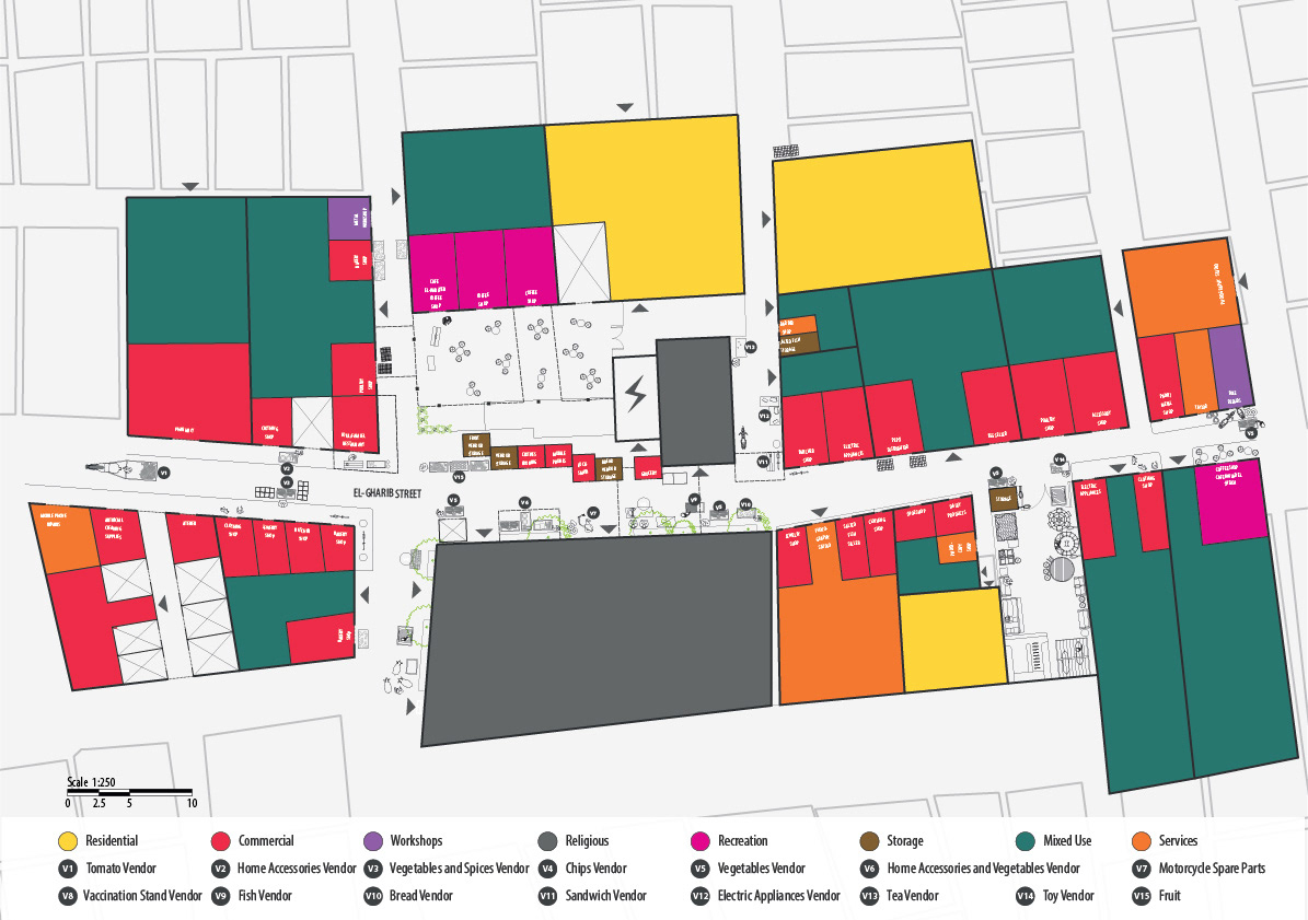
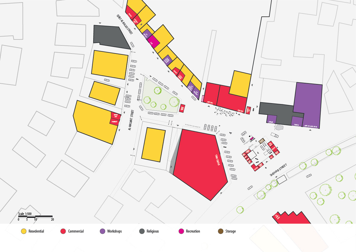
Land use - Shehab square and Al-Gharib Street in Mit ‘Uqba