Location: `Izbit Khayrallah - Cairo
The project aims at developing a comprehensive and inclusive upgrading plan for the public open spaces located along and underneath the Ring Road in `Izbit Khayrallah. This project aims at helping the local community of Khayrallah to improve their living conditions. Using a participatory design method, Takween ICD team implemented the proposed solutions, in participation with the area’s stakeholders, and the implementation of a pilot upgrading intervention in this area to be replicated by the authorities and other local partners. The project is supported by The Embassy of Switzerland in Egypt. It was designed and implanted by Takween Integrated Community Development with valuable logistical support from Cairo Governorate and a number of local NGOs in `Izbit Khayrallah. The preliminary studies, which I was a part of in this project were necessary in order to develop a clear analysis before the design.
Preliminary Studies
This analysis’ main focus was on the 5 tunnels located underneath the Ring road, dividing `Izbit Khayrallah in half. These 5 tunnels have a huge effect on the inhabitants’ daily lives and choosing only one to upgrade was an important decision that needed a full study. The following maps show different urban studies in relation to the location of the tunnels. This analysis made the team have a clear picture on which tunnel was more important than the other. In this study my task was to visualize the information given to me as a draft, also to create a homogenous visual language.
‘Izbit Khayrallah preliminary urban studies
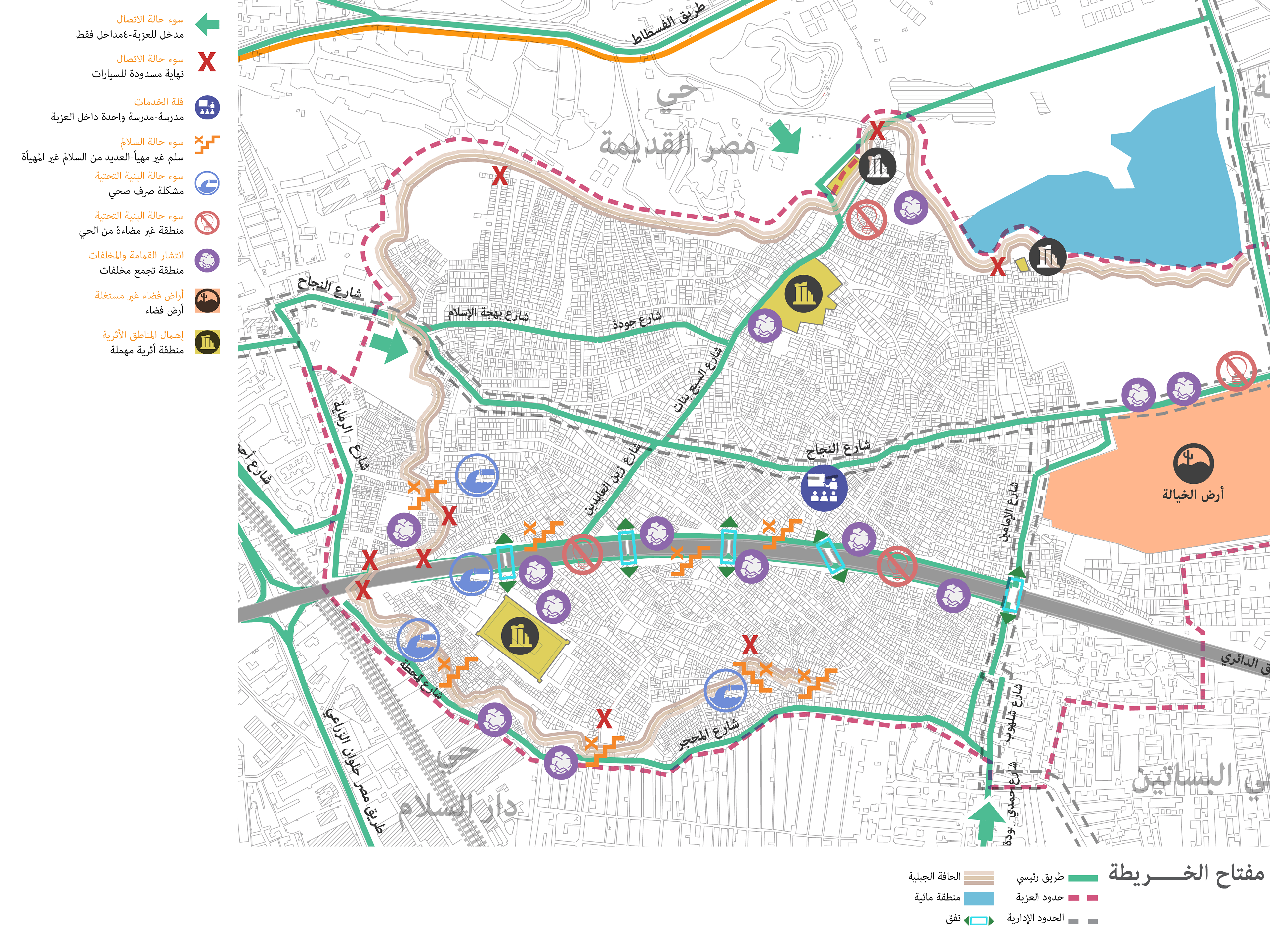
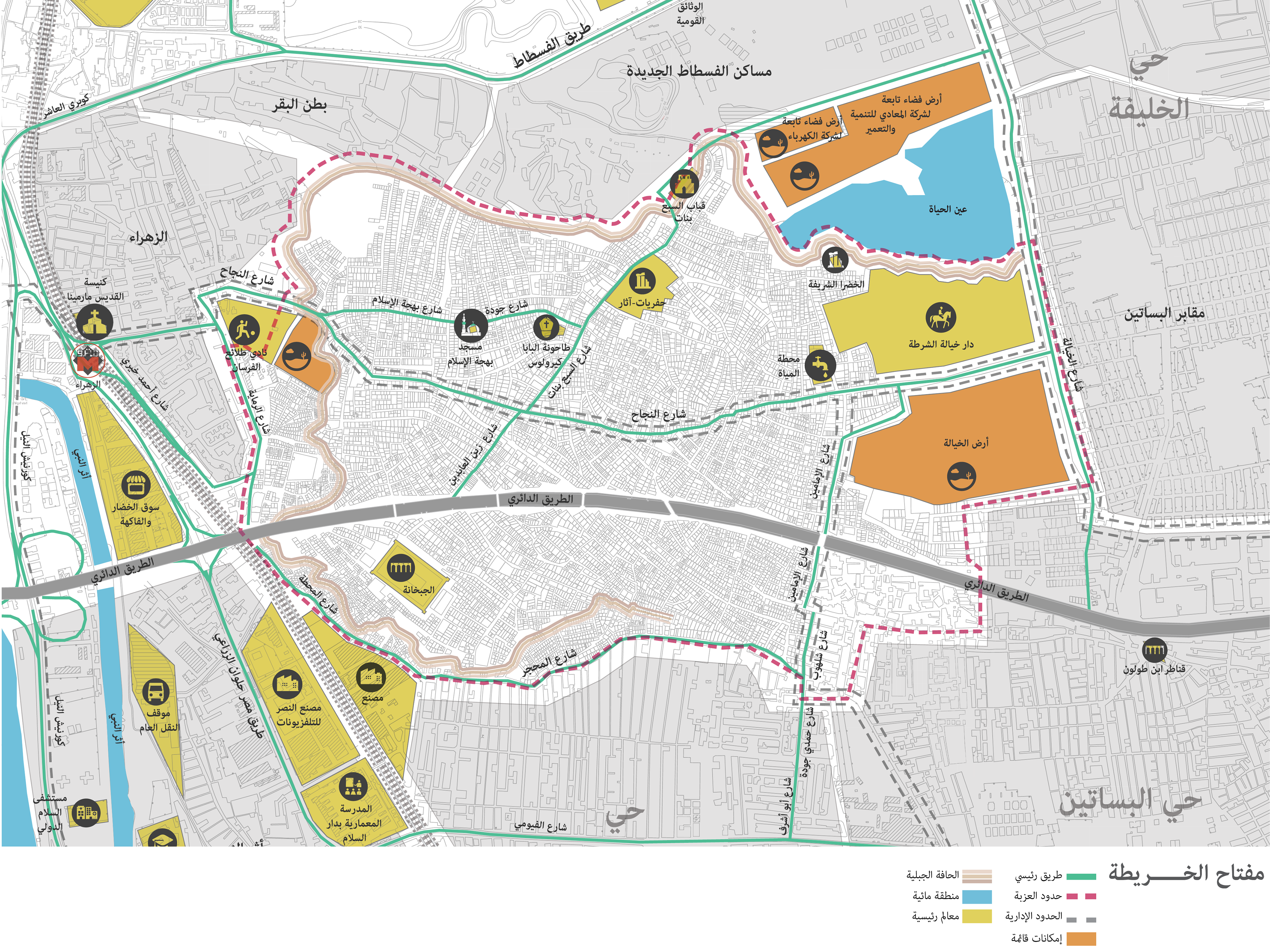
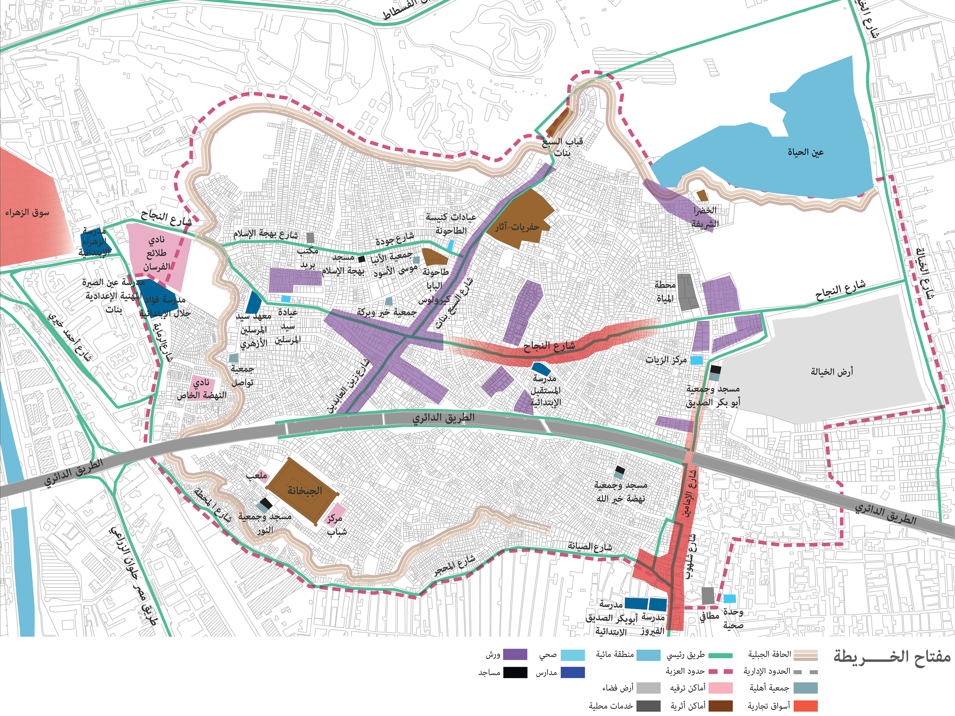
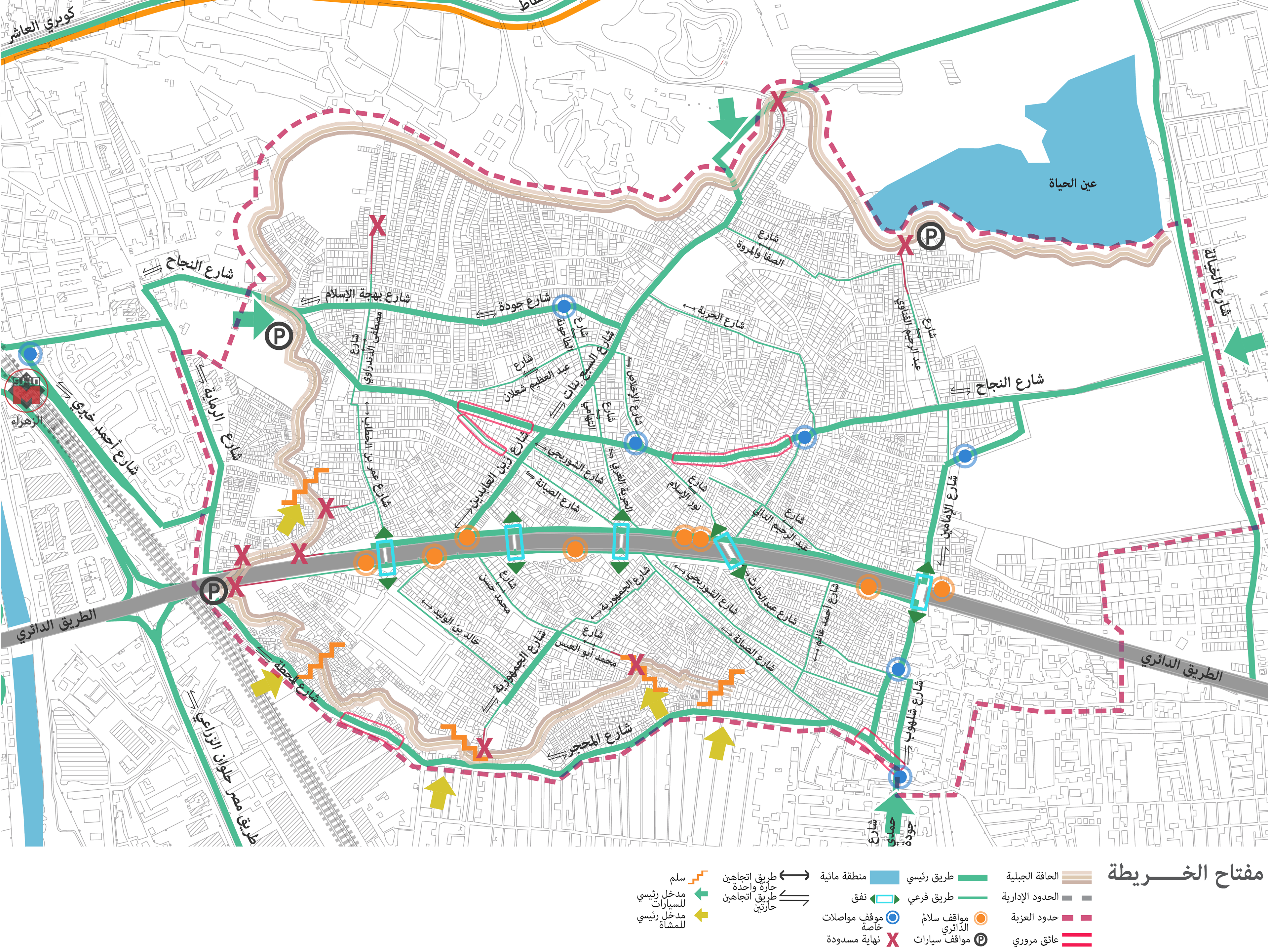
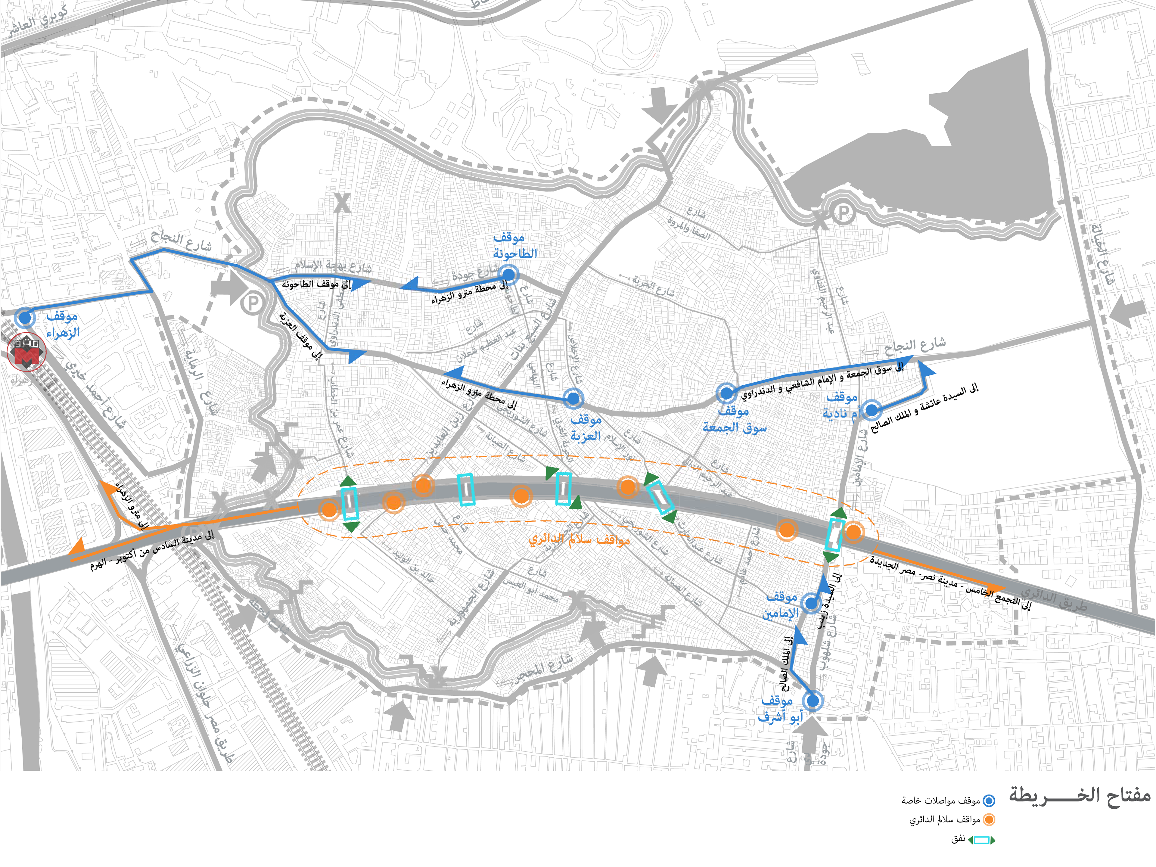
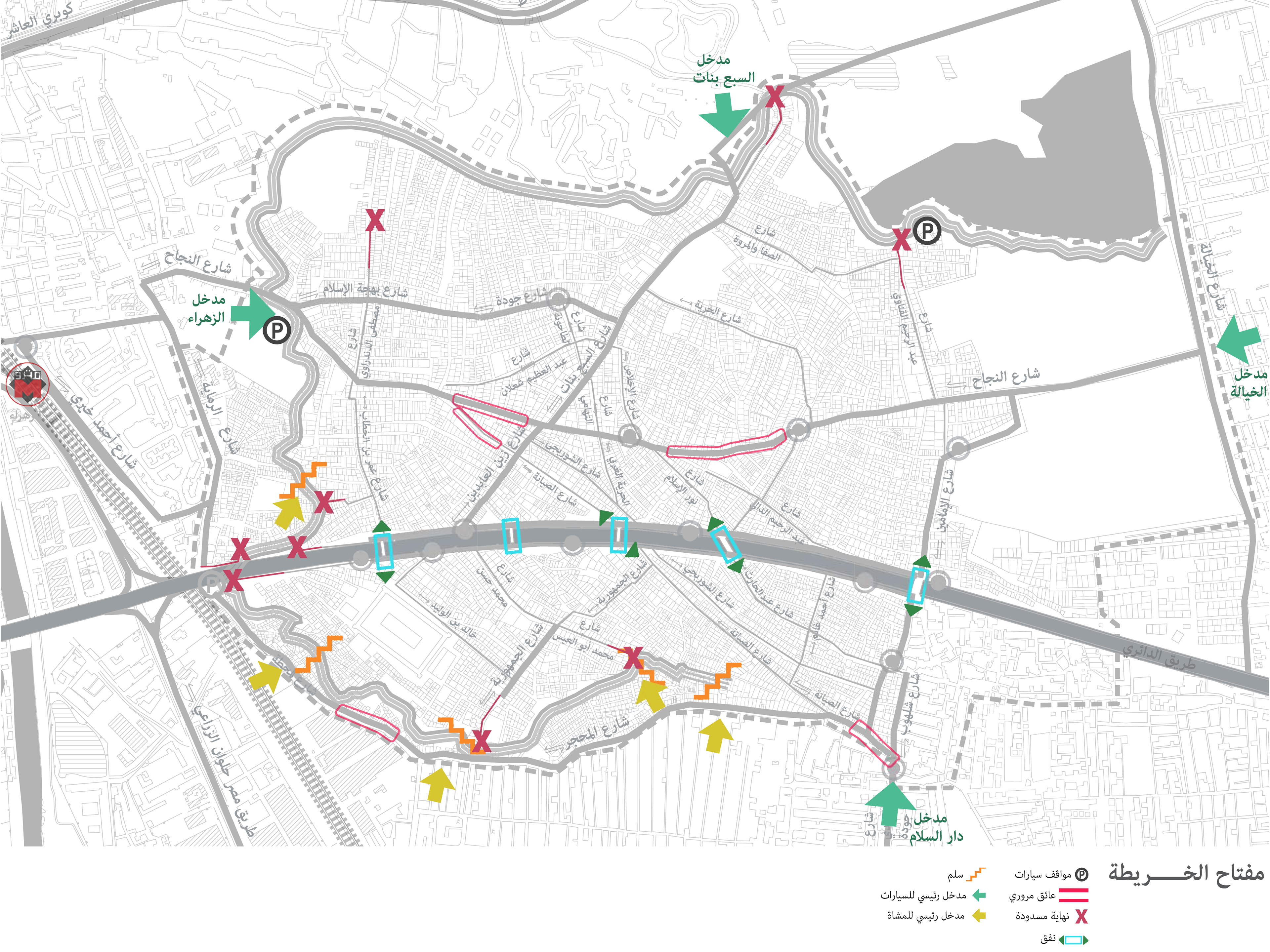
From left to right:
General problems facing `Izbit Khayrallah - Urban features - Activities and uses - Mobility and accessibility - Transportation system inside the neighborhood - Entrances, dead ends, parking spaces and traffic obstacles
Haram al-Da’ery Land Use analysis
Haram al-Da’ery streets are the most important to study in this project because of their parallel position to the Ring Road. Because of that they have a great influence on the 5 tunnels. Studying the streets’ land use can reveal the pedestrian and vehicular traffic in each tunnel based on the number of open shops.
Study of the Ring Road Staircases
11 stairs are self-built by the community along the Ring road, made as a solution to the physical division that was imposed on them by the government. The 11 stairs serve as access points to communte outside the area. The type of stair depends on many aspects; for a first the section of the Ring road is an important factor because if the height was too big the construction was impossible. The locations where it was easy to construct the staircase were the spaces where the height of the Ring road was small. The second analysis pin points the different staircases and what the residents use them for. By each staircase, different microbuses going to different places in Cairo can be seen. While choosing a tunnel to upgrade it is important to notice which staircases function the most and why, which will have a direct effect on the different tunnels.
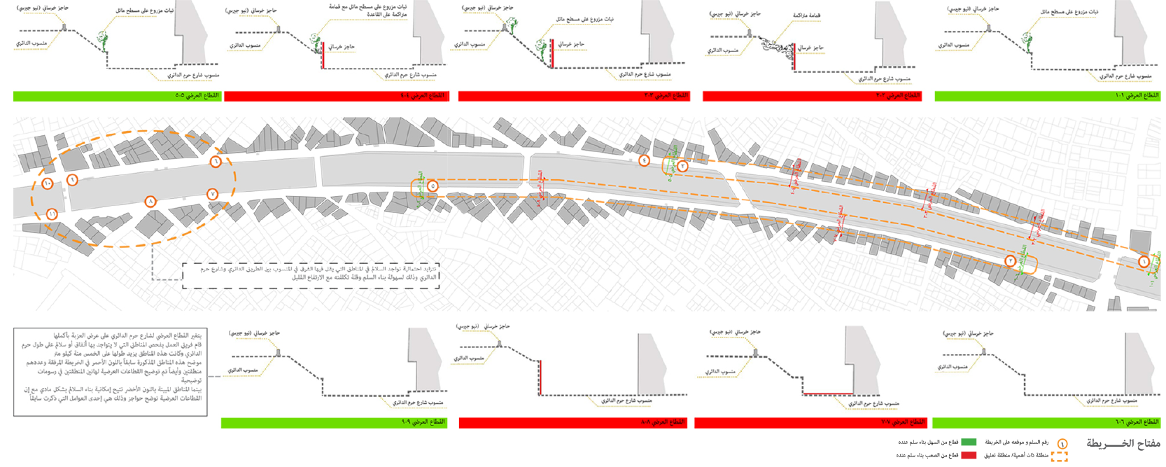
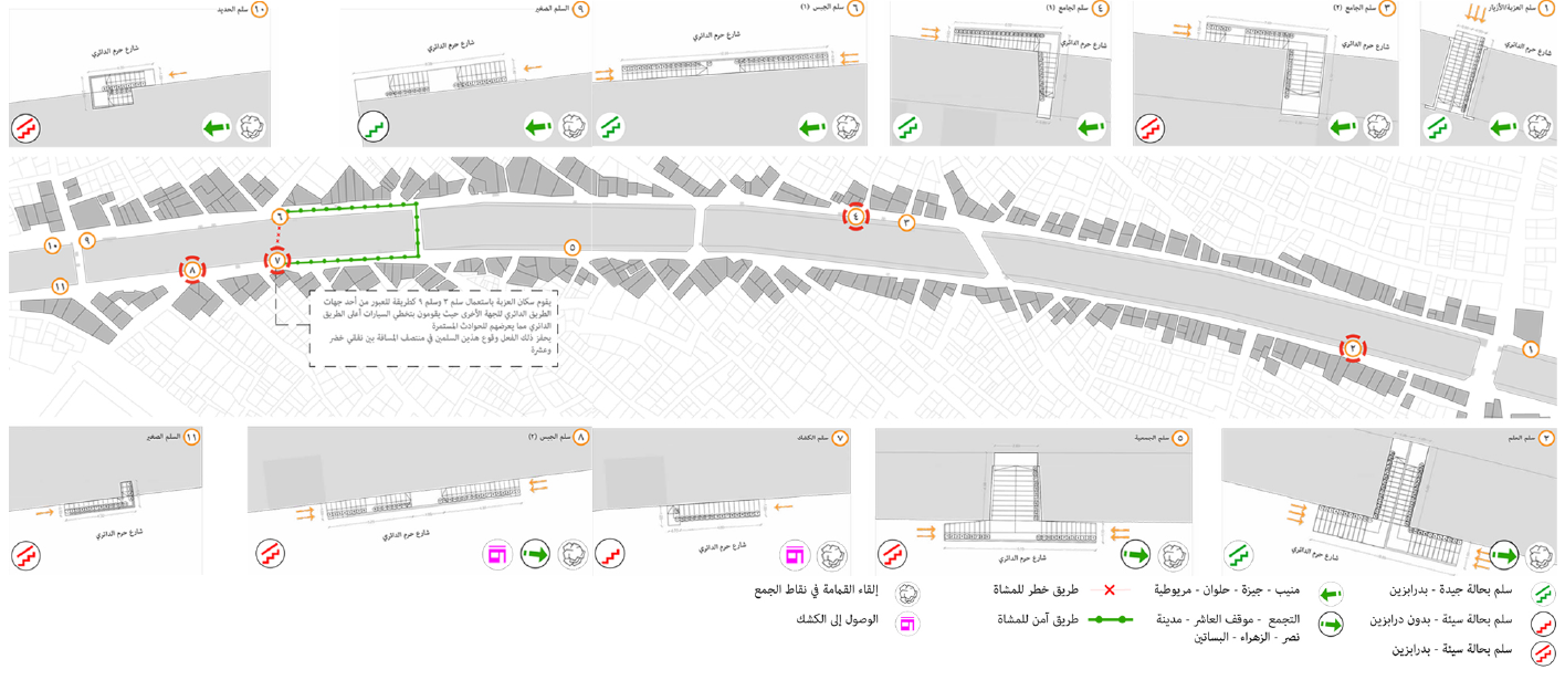
From left to right
Analysis of the construction of the stairs - Different uses of the staircases